⏱️ Lectura: 11 min
In May 2026, a military GPS jamming exercise at White Sands, New Mexico, left a medevac plane without satellite navigation, and minutes later it crashed into a mountain near Ruidoso. All four occupants died: two pilots and two flight nurses.
📑 En este artículo
It is the first civilian plane crash in the United States directly linked to electronic warfare, and it comes amid a global escalation of GPS jamming exercises that already number more than ten reported cases in a year.
TL;DR
- A Beechcraft King Air medevac plane crashed on May 14, 2026 near Ruidoso, New Mexico, killing 4 people.
- The FAA had warned that GPS could fail within a 400-mile radius between May 12 and 18.
- The military exercise NAVFEST, run by the 746th Test Squadron, was jamming GPS at White Sands Missile Range.
- It is the first civilian crash in the US attributed to military GPS jamming (electronic warfare).
- Captain Keelan Clark, 30, had held a commercial license for 18 months; co-pilot Ali Kawsara, 23, had only 2 months in the role.
- The US Army issued notices for at least 10 similar GPS jamming exercises in the past year.
- The firm Cyviation warns that jamming already affects commercial routes hundreds of miles from actual conflict zones.
- Medevac flights have an accident rate closer to combat aviation than civilian aviation, according to the law firm Kreindler.
What Happened
The flight was supposed to be routine. A twin-engine Beechcraft King Air took off from Roswell shortly before midnight to pick up a patient in Ruidoso, about 60 miles away: a 30-minute trip under clear skies, 69 degrees Fahrenheit, no turbulence.
Onboard were Captain Keelan Clark (30) and First Officer Ali Kawsara (23), along with two flight nurses. Clark had held his commercial pilot license for just 18 months and had been promoted to captain the previous month. Kawsara had only two months in the role, with prior experience limited to cargo flights.
The night was nearly moonless and the area rural. With no visual references on the ground, the pilots couldn’t orient themselves by sight.
📌 Note: pilot Juan Browne, who hosts a plane crash investigation podcast, described this type of terrain as “a black hole”: with no town lights or visible horizon, the only possible reference is the cockpit instrumentation.
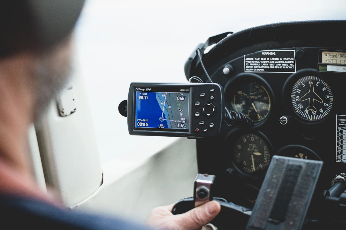
The pilots requested clearance to fly under instrument flight rules (IFR) from Albuquerque Air Traffic Control Center, and received it. Under normal conditions, the flight would have been completed by following the magenta GPS navigation line (RNAV) to landing in Ruidoso.
But 100 miles to the west, at White Sands Missile Range, the US Air Force was conducting NAVFEST, an annual exercise by the 746th Test Squadron (704th Test Group) that brings together electronic warfare units from all three military branches for two weeks to test GPS jamming and anti-jamming technology. The FAA had issued a notice (NOTAM) warning that GPS signal could degrade within a 400-mile radius between May 12 and 18.
At midnight on May 14, eight minutes after takeoff, Clark and Kawsara reported to Albuquerque Center that they had lost GPS signal. Forced to rely on navigation techniques they rarely practiced (ground-based radio beacons, magnetic compass, gyroscope-derived inertial systems), the pilots became disoriented and the plane struck the side of a mountain. There were no survivors.
Context and Background
White Sands was chosen for NAVFEST because it is one of the most remote and sparsely populated areas of the continental United States, the same reason the first atomic bomb was detonated there in 1945. But remote doesn’t mean isolated: the FAA notice covered a 400-mile radius, enough to reach active civilian routes.
The Ruidoso crash is not an isolated incident. In recent months, global aviation has reported a string of navigation disruptions: civilian drones drifting outside their authorized zones and, in the United States, a temporary airspace closure in New Mexico and Texas earlier this year that raised public alarm. That closure turned out to be caused by Customs and Border Protection (CBP) testing anti-drone lasers in the area, not an attack.
According to documents reviewed by Wired, the US Army issued notices for at least 10 GPS jamming exercises in the past year. Cybersecurity firm Cyviation already warns of this: “as drone warfare and electronic warfare expand, airlines are increasingly encountering navigation disruptions hundreds of miles from actual conflict,” according to CEO Eliran Almog.
GPS jamming is therefore no longer a risk exclusive to active conflict zones, but a latent risk for civilian air traffic within the United States as well.
Technical Details and Performance
To understand why losing GPS can be fatal, you need to understand what it replaced. Since GPS became widespread in commercial aviation in the 2000s, most pilots fly following RNAV (area navigation): the GPS receiver calculates the aircraft’s exact position and displays it as a magenta line on screen, including RNAV approaches that guide the plane to the runway threshold in reduced visibility.
Before GPS, planes navigated by combining ground-based radio beacons (VOR, NDB), magnetic compass, and gyroscope-based inertial systems. Navigating by radio beacons requires the pilot to maintain a 3D mental map of their position relative to each beacon, a skill that requires constant practice to avoid losing reference under pressure.
| Method | When It’s Used | Advantage | Limitation |
|---|---|---|---|
| RNAV / GPS | Modern standard navigation, precision approaches | Exact position, continuous on-screen visual guidance | Depends on a satellite signal that’s easy to jam |
| VOR / NDB (radio beacons) | Backup when GPS fails | Doesn’t depend on satellites, fixed ground infrastructure | Requires constant mental calculation and frequent practice |
| Inertial navigation (INS) | Large and military aircraft as autonomous backup | Works without external signal | Accumulates error over time, expensive to maintain |
| Visual references | VFR flight in good weather and daylight | Simple, no special equipment | Useless at night or in unlit areas (“black hole” effect) |
flowchart TD
A["Takeoff from Roswell"] --> B["Normal GPS/RNAV flight"]
B --> C["Enters NAVFEST zone"]
C --> D["GPS signal degraded"]
D --> E["Reverts to radio beacons and compass"]
E --> F["Loss of spatial reference"]
F --> G["Impact with terrain"]
Technically, a GPS jamming exercise saturates the L1 and L5 frequencies used by civilian receivers with radio frequency noise in the same band. The receiver can’t distinguish the real satellite signal from the noise, and in practice, HDOP (Horizontal Dilution of Precision) spikes while fix quality drops to zero.
Modern receivers include RAIM (Receiver Autonomous Integrity Monitoring), an algorithm that compares multiple satellites against each other to detect when the position solution is no longer reliable and alert the crew, instead of silently displaying a false position.
How to Detect GPS Jamming in Your Own Systems
If you’re building navigation software (drones, vehicle telemetry, GPS-enabled IoT), you can monitor these same indicators by reading the NMEA sentences that any standard GPS receiver emits.
import pynmea2

def parse_gga(sentence):
    msg = pynmea2.parse(sentence)
    return {
        "fix_quality": int(msg.gps_qual),
        "num_sats": int(msg.num_sats),
        "hdop": float(msg.horizontal_dil or 0),
    }

gga = "$GPGGA,235947.00,3327.5194,N,10521.7995,W,1,08,0.9,1000.0,M,-18.0,M,,*6E"
print(parse_gga(gga))
# {'fix_quality': 1, 'num_sats': 8, 'hdop': 0.9}
A fix_quality field of zero means the receiver completely lost its position: the clearest sign of active jamming. An hdop that suddenly jumps above 5 indicates severe degradation even if a fix is still present.
import time
import serial
import pynmea2

JAM_HDOP_THRESHOLD = 5.0

def monitor_gps(port="/dev/ttyUSB0", baudrate=9600):
    ser = serial.Serial(port, baudrate, timeout=1)
    while True:
        line = ser.readline().decode("ascii", errors="ignore").strip()
        if line.startswith("$GPGGA") or line.startswith("$GNGGA"):
            msg = pynmea2.parse(line)
            fix_quality = int(msg.gps_qual)
            hdop = float(msg.horizontal_dil or 0)
            if fix_quality == 0:
                print("ALERT: total GPS fix loss, possible jamming")
            elif hdop > JAM_HDOP_THRESHOLD:
                print(f"ALERT: degraded HDOP ({hdop}), possible jamming")
        time.sleep(0.1)
This script runs on any Raspberry Pi or microcontroller with a serial-connected GPS module, and serves as the base for an early warning system on drones or autonomous vehicles that rely on GPS as their only position source.
💡 Tip: if your system is critical (drones flying over people, autonomous vehicles), combine GPS with a multi-constellation receiver (GPS + GLONASS + Galileo) and, budget permitting, an inertial measurement unit (IMU) as a short-term backup when the fix is lost.
Impact and Analysis
The Ruidoso crash is, according to records reviewed by Wired, the first case in the United States where GPS jamming has been linked to civilian deaths on a plane. Kreindler, a law firm specializing in aviation accident litigation, notes that medevac flights already have an accident rate closer to combat flying than general civil aviation: they’re organized on short notice, land on unfamiliar runways, and because human lives are at stake, there’s an incentive to fly even in marginal conditions.
The convenience of GPS has an uncomfortable flip side: as it became the standard way to fly, many pilots increasingly practice classic radio-beacon navigation less. When GPS fails and pilots must return to older methods under pressure at night, the risk of spatial disorientation (losing track of up, down, and heading) increases. It’s the same phenomenon that, in 1999, led to the death of John F. Kennedy Jr., as retired pilot Kenneth Krentsa recalled when commenting on the case.
⚠️ Watch out: the risk isn’t limited to crewed aviation. The same GPS jamming exercises affect civilian drones and autonomous delivery systems operating on the same routes, without always having clear, timely notice for small operators.

What’s Next
NAVFEST is an annual event, not an isolated case: as drone warfare and electronic warfare expand in active conflicts, the US Army will keep testing and refining its ability to jam GPS on its own territory, with FAA notices that so far are limited to a text-based NOTAM without automatic alerts to onboard software.
Regulators and avionics manufacturers are expected to push toward multi-constellation receivers with more aggressive RAIM and toward more visible display of NOTAM warnings directly within navigation screens, instead of relying on pilots having read them before the flight.
📖 Summary on Telegram: View summary
Try it yourself: run the monitor_gps() snippet above against a real GPS receiver (or an NMEA simulator) and watch how the HDOP changes as soon as the signal gets jammed.
Frequently Asked Questions
What is GPS jamming?
It’s the intentional transmission of radio frequency noise in the same bands used by GPS receivers (L1 and L5), which prevents the receiver from distinguishing the real satellite signal and causes it to lose or degrade its position.
Why does the US Army jam its own GPS?
To train and test electronic warfare technology (jamming and anti-jamming) in exercises like NAVFEST, simulating combat scenarios where an adversary might block GPS.
How do pilots know if GPS is being jammed?
Modern receivers with RAIM detect when the position solution is no longer reliable and indicate it in the cockpit; in practice, loss of the RNAV signal and rising HDOP are the clearest signs.
Is it legal for the Army to jam GPS near civilian areas?
Yes, as long as the FAA issues a prior NOTAM warning about the affected area and dates, as happened with the 400-mile notice for NAVFEST between May 12 and 18.
What alternatives exist if a plane loses GPS mid-flight?
VOR/NDB radio beacon navigation, magnetic compass, inertial systems (INS), or, in good weather during daylight, direct visual references of the terrain.
Could something similar happen in Latin America?
Military exercises involving GPS jamming aren’t exclusive to the United States: any region with active electronic warfare bases and nearby civilian or medevac aviation faces the same risk if coordination with civil aviation fails.
References
- Wired: original reporting on the Ruidoso crash and the NAVFEST exercise.
- FAA: US federal aviation administration, issuer of NOTAM notices.
- NTSB: national transportation safety board, responsible for investigating plane crashes in the US.
- Wikipedia: general reference on how the GPS system works.
📱 Enjoy this content? Follow @programacion on Telegram for daily tech content in Spanish: quick summaries, fresh content every day. @programacion




0 Comments